Sunday 31 March 2024

St Maelruan's Tower & Monastery Site Co Dublin


                                            Above Image: View from main gate


                                        Above Image: Exterior steps to first floor


                                        Above Image: Granite cross West facing.


                                          Above Image: Granite cross East facing.


                                       Above & Below Images: St Maelruan's Losset


                       Above Image: Part of the remains of the monastery embankment


                         Above Image: Tallaght Castle now incorporated into the priory


There is an abundance of history in and around the village of Tallaght and the Dominican priory at it's centre is the tail end of almost 1300 years of ecclesiastical history in the village which began in 769AD with the foundation of a monastery by St. Maelruan. In 1223 the Archbishop commissioned a palace to be built which in 1329 fortified against attack from the Wicklow clans. A tall castle tower was also constructed for further protection. The monastery slowly deteriorated over the years until in 1720 the then Archbishop had all but the castle tower torn down and a new Archbishops residence built. The castle tower now is the only remaining construct of the old site and has been incorporated into the current priory buildings.
Adjacent to the monastery site lies the church of St Maelruan which was constructed in 1829 by the board of first fruits and standing beside it is the tower of the non-extant medieval parish church. The tower stands four stories high with an external stairs leading to the first floor. Within, a spiral stairs reaches to the other floors. The third floor has a vaulted ceiling and above it a bell cote. The interior of the tower is generally not open to view.
Within the church grounds left of the main gate are a couple of remnants from the old monastic site. The first is the 60" wide St. Maelruan's Losset. It was probably named so as it's shape rembles that of an old wooden utensil for kneading bread. This granite losset was more than likely originally a font. The second item is just South of the Losset and is a 36" high granite cross on a circular base with an arm width of approx 22". Local lore is that it marks St. Maelruans burial spot.
As an aside, part of the old fosse embankment belonging to the monastery is still visible from the car park of the retail area behind the church. I eventually located it between DID electrical and Smyth's Toys. A small OPW plaque had been placed to mark it but had been moved further down by the property management just causing confusion. But eventually I informed them of it's relation to the monastery and they seemed surprised but said they would move it back. The tower of the Tallaght castle can be seen from the private car park of the retreat house in the priory grounds. We entered not by the main gate to the priory but through the side gate down the laneway on the Eastern boundary. We didn't meet any opposition to us photographing it and our visit was brief.

To find the site take the N81 towards Tallaght and upon reaching the junction with Old Bawn Road (R113) turn right into the village. Continue straight on through the next two sets of traffic lights and you will find the church gates on your left just past Fanagan's funeral home. You can park safely enough just outside the gate.

Saturday 2 March 2024

Old Knocksink Dam Co Wicklow


                                             Above Image: The track entrance


                                          Above & Below Image: The forest track


                                         Above Image: First sight of the remains


                                         Above & Below Images The Dam remains


                                     Above Image: Arch below the Knocksink bridge


                      Above Image: A fallen tree in Bog Meadow gives the appearance 

                                             of some huge sylvan creature grazing


I have always found that half of the joy in ruin hunting is finding historical remains no matter how large or small in hidden spots or out of sight in normal everyday places. Knocksink dam falls directly into this category.
The Knocksink bridge (1859) is located on the cusp of Enniskerry where the Glencullen river beneath winds through the extensive Knocksink woods from the Dublin mountains.
Probably no more than 100 metres West of the bridge are the scant but still significant remains of a small dam.
The dam in question was part of a hydro-electric system and apparently was linked in its day to providing electricity to Powerscourt Estate, seat of the Wingfields, the Viscounts of Powerscourt. 

The Enniskerry Electric Supply Co-op supplied local businesses and homes with power until the ESB took over in the mid 1940's. Enniskerry was incorporated into the Shannon electric system around 1942 and it was sometime following that the small dam on the river was deemed unecessary and was dynamited leaving only partial remains on the riverbank.
Though not a remarkable ruin it is well worth your while on nice dry day to take the rough track that leads from the top of the bridge adjacent to the Parish house and then begin to descend through a landscape of leafy ferns and bushes down a slope towards the river. At times it is stoney and uneven underfoot and be wary of a small concrete ridge that lurks under the vegetation. I tripped once or twice on this. Eventually if you track close to the river, which is barely more than a stream at one point you will find the dam remains. Down in the small gorge it is like another world and seems far away from the busier world above. The Knocksink bridge stands high in the distance dividing the woods from the area known as Bog Meadow, which is a wonderful public amenity.

To find the ruin, take the R117 from Kilternan towards Enniskerry. As you near Enniskerry you will pass a small sliproad on the right signposted for Knocksink Woods nature reserve. Drive on across the walled bridge and park at the main entrance to St. Mary's Parish Church. Then walk back to the entry to the old parish house and you will find the track entrance at the roadside to the right of the parish house entry. It has a streetlight pole beside it. Follow the track adjacent to the parish house wall and the begin to descend towards the river,

Monday 29 January 2024

Old Slate Quarry Valentia Co Kerry


                                               Above Image: Old mining tower

                                      Above Image: Part of the road to the quarry.


                        Above 3 pictures: Quarry cavern with grotto visible in lower two.


While touring the back roads of Valentia Island our attention was drawn to a sign for the Valentia slate quarry. So we drove off the beaten track to be eventually greeted by the sight of a huge cavern.
The slate quarry was originally founded in 1816 by the 18th Knight of Kerry, Maurice Fitzgerald (1772 - 1849).  Its purpose was to supply materials for roofing and flooring. The excellent quality of the slate quickly gained a reputation becoming much sought after and word of it soon reached far and wide.  A dedicated pier was constructed in 1835 for the purpose of exporting the product and subsequently led to the founding of the small village of Knightstown. Both were designed by Alexander Nimmo, the Scottish born surveyor and engineer.
The slate has been utilized by among others the great London cathedrals and in stations on its underground system but also notably in the Paris opera house.
In 1858 one of the quarry buildings was involved with the transatlantic cable project.
Between the years 1880 and 1900 the quarry closed but reopened for a few years until disaster struck in 1911 when a huge rockfall ceased all operations. In 1991 a group of entrepreneurs reopened the operation and hired some Ukranian workers to work the mine so that modern generations could once again avail of this excellent slate.
When we visited there were one or two hard hats walking around but it was generally quiet. I believe that in season a tour can be made to some extent of the mine interior but this was not available on our visit which was unfortunately just out of season.
The huge cavern excavated from the North-Eastern slope of Geokaun mountain is a terrific sight and in the Marian year of 1954, on an upper crevice, two statues were placed to form a grotto. You can see them clearly in the above photos. They were reached by a ladder which now lies on the ground underneath the grotto. On the approach to the cavern is the lonely ruin of a tower which as it turned out was the only remnant remaining of the long gone machine house.
To reach the quarry, leave from the pier at Knightstown turning left at the Royal Hotel and then driving approx. 250m until you reach a fork in the road at the newer church gate. Take the right hand fork (which is School Road) and drive approx. 1KM where you will see the ruined tower of old Kilmore church on your left (see previous post here) Continue driving on this road for approx 1.6KM (be careful as at times this road is very narrow) until you reach a staggered crossroads. Follow the sign for the quarry which is straight ahead and drive approx 1KM and you will then reach the quarry. There is parking in front of the barrier at the cavern.

GPS
51.92354. -10.34278


Tuesday 19 December 2023

Old Greenogue Church Co Meath


                                               Above Image: Southern aspect


                                                 Above Image: Roadside stile


                                          Above Image: Entry gate to graveyard


                                               Above Image: Northern doorway


                                    Above Image: Dividing arch and inner building


                                          Above Image: Remains of Western wall


                                                   Above Image: Northern wall


The first mention of a church here which is dedicated to St. Nicholas was in the ecclesiastical taxations of 1302 - 1306 where it was referred to as Greenock. This would probably date the church to at least the late 13th century. It has at times also been referred to as Grenoke. The church served as a catholic church until Cromwellian times when it was then either reformed into a Protestant church or was laid to ruin by the invading army. In any event it's condition is recorded in the 1837 Samuel Lewis publication "The Topographical Dictionary Of Ireland" as being "considerable remains".
On our visit we parked at a roadside gate which had a V-shaped stone stile to the side. The laneway leading up to the church is slightly inclined and made up of gravel and is parallel to another lane leading to a private dwelling. At the top of the gravel path there is an entry gate on the right, with the ruins clearly visible. This is unlocked and it is within the enclosure that our interest lies. The ruins are sited on a grassy ridge of ground facing in an East-West direction and are surrounded by graves on both the North and South sides. All four walls still stand to varying degrees with a complete arched doorway in the North facing wall and partial doorway in the South wall. Between the nave and chancel areas is a large archway and what appears to be a seperate block which may have been a vestry or a possible stronghold for the clergy. It does not fit well into the layout of the inner church so it may have been a later addition. It can be entered through a rectangular orifice in the North wall which is approx two feet from the ground and appears more of a window than a doorway.

On an outer wall there is a plaque with the following inscription:

"In Memory of
Fr. Pat Ferrall P.P.
Greenogue, Donaghmore.
1789 / 1801
Active in the Rebellion of 1798
He was a stern and uncompromising Patriot R.I.P."

Singer Sean Dunphy who represented Ireland in the 1967 Eurovision Song Contest is among those buried in this graveyard.

To find the ruins take the M2 heading North and exit at junction 3. Follow the long slip road until you reach the Nine Mile Roundabout. Take the third exit signposted for the R125 to Swords. Continue on this road for approx 2.4KM and you will spot the ruins on elevated ground on your right. You can park offroad in front of the stile without inhibiting access to the private dwelling gates adjacent.

 Coordinates: 53.4885 | -6.34932

Tuesday 31 October 2023

Ballycarbery Castle Co Kerry


                                           Above Image: Approach road to castle

                                                 Above Image: North East tower


                            Above Image: Castle with car parking area in foreground


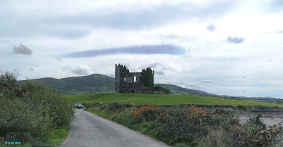
This impressive castle was constructed during the 16th century on the site of an earlier 13th century structure. It commands a view over the estuary near Cahersiveen.

The castle was thought to be a residence of the McCarthy Mors who were successful traders and the position of this residence to the estuary was intended for more commercial than strategic reasons. It was later acquired by Sir Valentine Browne, a landowner, who lived in Ross Castle near Killarney. In 1652 during the confederate wars Ballycarbery was under siege by parliamentary forces and suffered damage from heavy cannon fire. In the years following it fell into ruin. Today the high wall that surrounded the castle has been diminished by sixty percent and the entire rear of the castle is now non-extant.

Only one chamber remains vaulted and it is located in the North East tower . It contains an awkward stairs leading to the remains of the first floor with another damaged stair on on the exterior. .Up to a few years ago accessibilty to the ruins was possible but of late the landowner has posted several prohibitive signs denying access probably due to the crumbling stonework but also more likely for insurance reasons as people would be apt to climb the stairs. It was therefore a little disappointing on our visit to discover this situation. I'd imagine there is probably still some trespassing done but any movement around the ruins is highly visible. That aside it is still an easy drive to the site and it's in a scenic spot .There is a rudimentary and very sandy car park right in front of the old field entrance and you can also take a walk down to the strand for an alternate view. While there we met an Australian lad who was very interested in this blog and for whom I have to thank for promoting it down under!

To find the ruins take the turn in Cahersiveen town onto Bridge Street (at the architecturally pleasing community resource centre) Once across the estuary bridge drive for approx. 600m until you reach a small crossroads. Turn left at the crossroads and drive approx. 1.4KM until you see a left hand turn signposted for the castle. Drive to the bottom of this lane until you reach the small car park.

Saturday 30 September 2023

Old Kilmore Church Valentia Island Co Kerry


Above Image: Iron railing denotes former nave
                                         
                                          Above Image: View up the tower interior


                                             Above Image: The arched doorway


In the far Southwest of Ireland on the Skellig coast lies the Island of Valentia, a small but un-spoilt corner of the country. The Island not unlike Achill in County Mayo is very close to the mainland and is reached either by bridge or a short five minute journey on a car ferry.
It was on Valentia that we found the rather lonely looking tower of old Kilmore church which served its community for a short period in the 19th century.
It was built during the time of the Board of First Fruits, an institution of the Church of Ireland designed through grants to fund the founding of and improvement of its churches in Ireland.
Kilmore was completed in 1815. It was designed by James Pain and purposed to hold up to sixty people. Years later it became too small to accommodate the growing congregation and so a newer larger church dedicated to St. John the Baptist was constructed in 1860 within the island's singular village, Knightstown.
The old church fell into rack and ruin by the turn of the century after decades of dereliction until finally later in the 2oth century, the nave was completely demolished leaving only the tower as a sentinel to the graveyard it inhabits. An iron railing maps the outline of the now demolished nave.
The ruin is located just off a narrow road the leads from Knightstown towards the lighthouse at Cromwell Point. A small iron pedestrian gate gives access from the roadside and the tower stands on elevated ground within. It stretches three stages in height and is silhouetted against Kilbeg mountain in  the backround. We found the remains of an arched doorway in the South facing wall and within you can see right up through the tower to the now open top. The summit of the tower has a castellated design.
It's a lonely spot in a bucolic setting and the wind seems to swirl in circles around the tower adding to the feeling of solitude that exudes from the place.
To find the ruin, leave from the pier at Knightstown turning left at the Royal Hotel and then driving approx. 250m until you reach a fork in the road at the newer church gate. Take the right hand fork (which is School Road) and drive approx. 1KM and you will see the tower on your left. You can park off road at the gate. Alternatively if you are crossing the bridge from Portmagee take the R565 and drive until you reach the said church gate in Knightstown, then follow the previous directions down School Road towards the tower.

Sunday 13 August 2023

Dungarvan Old Church Co Kilkenny


                           Above Image: The South facing walls of nave and tower

                                Above Image: The North facing wall and East gable


                                        Above Image: A view up the tower interior


I spotted this looming ruin while passing through the small village of Dungarvan in Co Kilkenny. 

This tall Church of Ireland church was constructed in 1812 as part of the ambitious first fruits initiative which established a swell of new churches with quite a few of them today lying in ruin. This particular one lasted about 90 years of service before it fell into disuse in the early 20th century. The church is single-celled with a tall four stage tower on the West side. It sits on the site of an earlier medieval church which had a bellcote and while no trace of that church remains there are however some ancient grave markers from the time scattered throughout the site. Most of the windows of the tower are now  blocked up including those on the the original level which contained the bell. On the main building there is a large arched window in the East gable and two further windows on the South wall only. The doorway is in the north wall of the tower and while no access is possible to the nave you can see right up through the interior of the tower. The tower itself is architecturally interesting in the way that each level is slightly smaller giving the tower an impression of more height.

The ruin lies in a walled graveyard behind the modern church in Dungarvan village which lies on the R448 between Thomastown and Gowran. You can park in front of the new church and take the gate here in toward the ruin at the rear.


GPS  52° 35′ 11.62″ N, 7° 05′ 39.77″ W